
Trace a Roswell Street Address
A sound Roswell street search begins with place, not a guessed resident. Standardize the address, confirm that it falls within the Roswell city-limit layer, and then copy the parcel identifier and legal description. The parcel card gives the current tax owner and keeps the property address apart from the address used for tax mail. A deed then connects that owner to the prior party. Voter and criss-cross records may add resident evidence, but neither should be treated as a complete household list.
- Enter the full address in Roswell GIS. Confirm the street, city limit, parcel, subdivision, and address point.
- Open the Fulton Board of Assessors search. Copy the parcel ID, owner, situs, mailing address, and legal description as separate facts.
- Use the current owner as grantee in the GSCCCA real-estate index. Record the deed type, date, book and page, instrument number, and grantor.
- Check the Roswell permit system and legacy city files by the same standardized address. A permit can date work and name an applicant or contractor without proving who lived there.
- For a historical household, consult Haines criss-cross volumes in house-number order. Use a lawful elector-list request only when voter data is truly needed.
The chain is address to parcel, parcel to owner, owner to deed, and then address to other evidence. Keeping each link on a worksheet prevents a matching street name from joining two different parcels.
Map Roswell Streets and Parcels
Roswell maintains address, street-centerline, parcel, building-footprint, subdivision, zoning, watershed, and city-limit layers. Those layers settle a key geography problem: a mailing label that says Roswell does not by itself prove City of Roswell jurisdiction. Fulton GIS supplies the county parcel view, while the city map adds municipal context. Search one address, zoom until lot lines appear, then click parcels one at a time along the road.
Fulton's inspected Property Map Viewer offers Global Search, Identify Parcel, measurements, an attribute table, print tools, drawing, and layer controls. Its historic aerial imagery includes selected years from 2000 onward and annual views from 2015 through 2024. Imagery may help date a visible site change, but it does not replace a permit or deed.
Open the Roswell GIS source page before using its address layers.
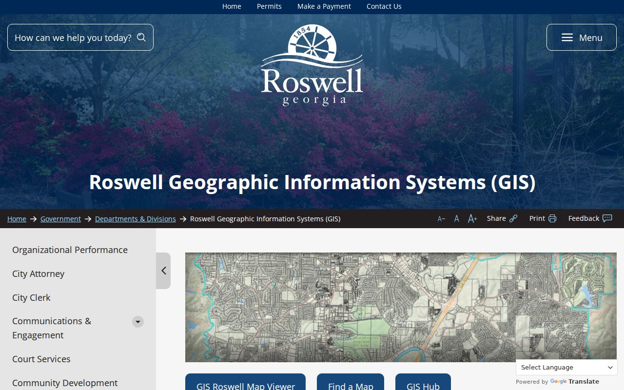
The captured page identifies the city-maintained map layers and viewer entry point that anchor a street-by-street search.
Note: Visual adjacency helps organize research, but only a recorded plat or legal description establishes a legal parcel boundary.
Read Roswell Parcel Records
The Fulton parcel layer exposes ParcelID, tax year, situs address, owner, owner mailing lines, tax district, land and improvement values, land-use and exemption codes, living units, acres, neighborhood, subdivision, lot, block, and mapped geometry. A parcel record is a current-owner lead. It is not a roll of everyone at the address. A homestead exemption can support an owner-occupancy inference, yet it still says nothing certain about relatives, renters, or other household members.
| Roswell search field | Input | Best use | Caution |
|---|---|---|---|
| Owner Name | Surname or business | Find parcels tied to a known owner | Use spelling variants if supported |
| Location Address | Street address | Match the taxable site | Not the owner's mailing line |
| Parcel Number | County parcel ID | Return the cleanest property match | Copy it exactly |
| Legal Description | Subdivision, lot, or land text | Bridge a changed street address | Confirm against the deed |
The assessor interface was access-challenge blocked during research, so these documented modes should not be described as a live screen inspection. The Fulton GIS service, however, confirmed the underlying parcel fields. Quote the situs and mailing lines separately in any notes.
Roswell Records Indexed by Address
No single Roswell street directory captures every person. Instead, several address-keyed sources overlap. The parcel and GIS records are the strongest current place-and-owner pair. Deeds carry ownership backward. Permits document work, applicants, and contractors. A lawfully obtained voter list can show registered electors with protected fields removed. Printed reverse directories and the public census add historical household evidence.
| Address source | Record keeper | What it can show | Access route |
|---|---|---|---|
| Parcel roll | Fulton Board of Assessors | Owner, situs, mailing line, parcel facts | Free property search |
| GIS layers | Roswell and Fulton GIS | Lots, addresses, buildings, city line, subdivision | Public map viewers |
| Recorded deeds | Fulton Clerk | Grantor, grantee, legal description, recording | GSCCCA, Deed Room, mail copy |
| Permits | City of Roswell | Address, work, applicant, contractor, status | HUB or open-records request |
| Elector list | Georgia SOS and Fulton Elections | Authorized public registration fields | Paid statutory list request |
| Reverse volumes | Fulton Special Collections | Historic names and firms in house-number order | Walk-in shelf use |
Access does not stop at a portal. Older deeds may require the Deed Room or a mailed copy request. Legacy permits may need city staff to associate an old record. Bound reverse volumes are used at Central Library Special Collections rather than searched as one complete online Roswell database.
Turn Roswell Parcels Into Deeds
Fulton County's clerk records deeds and also serves as clerk for Superior and Magistrate Courts. For land, start with the acquisition deed cited on the parcel card or search today's owner as grantee. A grantee receives an interest; a grantor transfers it. Record the instrument type, recording date, book and page, instrument number, and exact legal description. Then search the grantor as an earlier grantee. Repeat that pattern rather than chaining by street wording alone.
The county-specific online index displayed a January 1, 1987 “Good From” date during inspection. It supports name, book/page, and property searches, with party, instrument, county, and date controls. Earlier land instruments remain at the Fulton Deed Room, whose stated holdings reach the early 1800s. Public computers are available there, and mailed requests can use a known document type plus book and page. Images, copies, and certification may cost even when index searching is free.
- Parcel
- A mapped unit of land identified by the county for assessment and record matching.
- Situs address
- The physical location of the taxable property, kept apart from the owner's mailing address.
- Plat
- A recorded map showing lots, boundaries, streets, and related survey information.
- Criss-cross directory
- A reverse directory arranged by street and house number instead of only by surname.
Note: The deed index proves that an instrument was recorded; it does not establish that a named party lived at the property.
Search Roswell Permits by Address
Roswell's Permitting & Licensing HUB covers applications, plans, invoices, inspections, and status work. The public may browse available permit and license types or pay an invoice without an account. Applying, checking status, scheduling inspections, or managing a license requires a registered account. An address search may uncover additions, repairs, inspection steps, an owner, applicant, or contractor, but those roles are not proof of residence.
The city migrated active permits and applications into the newer HUB. Records that did not match after the October 13 migration may require staff association. For a missing legacy file, contact Resident and Business Services or submit a focused Roswell open-records request naming the exact address, department, date range, permit number if known, and desired file format. Georgia's Open Records Act generally calls for production or a written timetable, cost, or exemption response within three business days.
Address evidence can also occur in a city incident file. Review the Roswell Fire and EMS records rules before requesting one.
The city asks for an incident date and location. Medical reports have identity and authorization limits, while nonmedical incident reports have broader access subject to applicable restrictions.
Resolve Roswell Address Mismatches
Postal Roswell, municipal Roswell, and a Fulton parcel are three distinct layers. The 30075 and 30076 postal areas can cross civic lines, so do not route a city permit request from the ZIP alone. Verify the USPS wording, compare the assessor's situs line, and inspect the Roswell city-limit layer. The deed's subdivision, lot and block, or metes-and-bounds description can remain stable when a road name or mailing convention changes.
History adds another break. Roswell belonged to Cobb County until annexation into Fulton in 1932. A deed, probate file, tax digest, or court clue from before that date may therefore sit under Cobb rather than Fulton. Earlier land can also point toward state land-lottery records. The shift is a custodian change, not evidence that a family moved.
Reverse Historic Roswell Streets
Fulton Central Library Special Collections holds Haines criss-cross directories from 1946 through 2016-2017. These volumes arrange entries by address and telephone, making them the historical street directory tool for a house-number sequence. The broader collection also carries city directories through 1991 and street-name-change evidence spanning 1859 to 2017. Coverage is metropolitan and can vary by volume, so check each Roswell heading rather than assuming every year includes the city.
Use the reverse shelf only after the modern address has been normalized. If the number vanishes, inspect nearby editions and the collection's street-name evidence. The full shelf, edition keys, and historical reading method belong to the Roswell directory book page. Special Collections accepts walk-in use and advance questions by email.
Roswell Voter Records by Street
Georgia My Voter Page verifies one elector with an initial, last name, county, and date of birth. It is not a browseable Roswell street directory. A public elector-list request is a separate process governed by O.C.G.A. §21-2-225 and current rules. The request specifies geography, fields, format, and date. Fulton Elections administers Roswell voters, while the Secretary of State supplies listed voter-file products.
Authorized data can include a name, residence or mailing information, registration status, precinct or district, and participation history. It does not disclose vote choice. Full birth dates, Social Security numbers, driver's-license or state-ID numbers, phone numbers, and protected VoteSafe addresses are withheld. Georgia has no party registration. Inactive status also does not prove that a person moved on a known date.
Street-search distinction. My Voter Page checks one person's registration; a street-level file requires a lawful order and still suppresses protected data.
Limits of Roswell Street Records
Ownership is not occupancy. A parcel card can name a trust, company, estate, or owner who receives mail elsewhere. It usually omits renters and other people in the household. A deed identifies recorded parties. A permit identifies roles tied to work. A directory is a dated publication snapshot, and voter data excludes many people by design. None of those sources is a complete list of who is at home now.
Protected programs matter as well. VoteSafe and Georgia's address-confidentiality safeguards remove qualifying residence details. Private HOA rosters, utility customer lists, congregation lists, delivery records, and private contact books should not be treated as open resident rolls. When an online result is absent, the record may still exist at a counter, in a legacy city system, or on a library shelf, but that gap is never a reason to invade a person's privacy.
Lawful use. Use Roswell address records only for legitimate personal research, property history, genealogy, or civic inquiry. Never use them to stalk, harass, threaten, or harm anyone.