
Roswell ZIP Code Directory Coverage at a Glance
The two current street-delivery ZIPs confirmed for postal Roswell are 30075 and 30076. Their broad descriptions help select a starting area, but official sources do not publish a block-by-block neighborhood narrative. Historic, central, west, and east labels are practical map summaries, not legal lines. Check every address through USPS and then test municipal jurisdiction in Roswell GIS.
| ZIP Code | Areas Covered | Post Office | Notes |
|---|---|---|---|
| 30075 | Central, west, historic, and north/west residential Roswell areas | Crosstown Carrier Annex, 225 E Crossville Road | Postal city can extend beyond the municipal line |
| 30076 | East and southeast Roswell, including the Holcomb Bridge and Ga. 400 area | Roswell Post Office, 8920 Eves Road | Check civic jurisdiction in GIS |
| 30077 | Legacy or auxiliary Roswell reference | Verify current use with USPS | Not confirmed as a current residential or PO-box ZIP |
USPS identifies the 30075 annex as carrier and pickup oriented. The 30076 office lists round-the-clock PO-box access, and a postal store operates on Alpharetta Highway. Archived material mentions 30077, but the inspected current USPS city-label list and Fulton health profile did not. The Roswell ZIP code directory therefore treats it as a lead requiring live USPS confirmation, not as a current resident zone.
Three Roswell ZIP Geography Layers Must Agree
Postal Roswell, incorporated Roswell, and a Fulton parcel are three distinct layers. The mailing line is set for delivery. The city-limit layer decides municipal jurisdiction. The parcel database supplies situs and land details. Mountain Park's inclusion in the county's Roswell ZIP health profile shows in concrete terms why a Roswell postal label does not settle the city question.
USPS mailing record
Confirms the standardized address, delivery city, and current ZIP used to route mail.
Roswell GIS
Shows the city-limit, street, address, subdivision, and parcel context around the site.
Fulton parcel record
Provides a situs field, parcel ID, owner record, and legal or subdivision clues.
Do not collapse these layers into one claim. An address can say Roswell for mail yet receive county or another authority's services. Near an annexation edge, the map and custodian matter more than the city word on an envelope.
Verify a Roswell ZIP With USPS and GIS
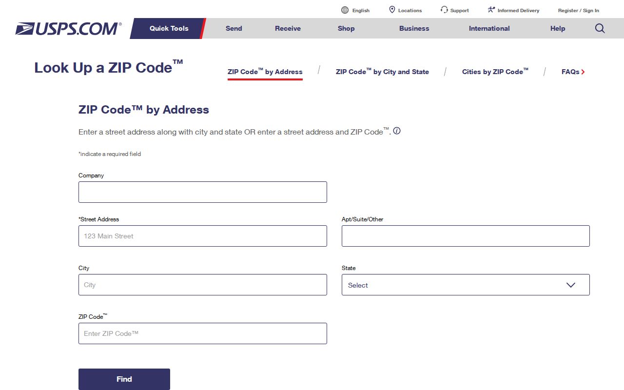
Begin with USPS ZIP Code Lookup by Address. Enter the full street address, city and state as known, then preserve the standardized response. Next search the same address in the City of Roswell GIS and turn on city limits, addresses, and parcels. Finally, compare the Fulton assessor situs. This is stronger than relying on a third-party map whose boundary date and method are unknown.
The USPS ZIP Code Lookup is the source for the postal check shown below.
If the sources differ, do not edit one to match another. Record the USPS form for mail, the assessor situs for the parcel, and the GIS jurisdiction as separate facts. A deed's lot, block, subdivision, or metes-and-bounds description can remain stable when postal wording changes.
Read Roswell ZIP Fields on a Fulton Parcel Result
The Fulton parcel service is built around property, not residents. It can expose the parcel ID, tax year, situs address and components, owner, owner mailing lines, tax district, values, acreage, neighborhood, subdivision, lot, block, and geometry. When a location result includes a ZIP, that field helps group parcels, but it does not create a list of occupants.
| Parcel field | What to record | What not to infer |
|---|---|---|
| Situs address | The location assigned to the taxable parcel | That every household member appears |
| Owner | The name on the tax record | That the owner occupies the site |
| Owner mailing | Where the tax notice is sent | That it is the parcel's ZIP |
| Parcel ID | The county database key | That it replaces a legal description |
| Subdivision, lot, block | Land-description clues | That a postal boundary controls title |
This distinction is vital in a ZIP code directory. Owner mailing and situs may be in different delivery areas. Homestead information can support an owner-occupancy clue, but it still does not name a spouse, child, or any other resident.
Find Roswell Records Within One ZIP Code
Use the ZIP to reduce the area, then move to an official record keyed by a name, address, parcel, or lawful list geography. Neither USPS nor GIS is a resident roll. The assessor's location results are property records, and My Voter Page is a one-elector self-check rather than a way to browse everyone in 30075 or 30076.
- Verify the full address and current mail ZIP with USPS.
- Check the address against Roswell city limits and parcel layers in GIS.
- Open the assessor location result and distinguish situs from owner mailing.
- If election data is needed, use self-lookup or request an authorized existing list with precise geography and fields.
- Confirm any person through a second independent record rather than assuming a parcel owner is an occupant.
Once a postal area is narrowed to a named road, the Roswell street directory walkthrough explains the address-level parcel and deed path. That shift from ZIP to street is where a broad search becomes testable.
Roswell ZIP Filters Do Not Replace Voter-List Rules
Georgia My Voter Page asks for first initial, last name, county, and date of birth. It can return the user's status, polling place, precinct and district facts, sample ballot, and participation functions. It does not accept a ZIP as an open public browse of nearby electors.
A lawful public-list order is separate. The requester should state geography, fields, format, and date. Public data may include name, residence or mailing information, status, precinct, district, and authorized participation history. Social Security and identification numbers, full birth date, phone numbers in the supplied file, and protected VoteSafe residences remain withheld. A ZIP group is therefore bounded by both postal uncertainty and election-law access rules.
Why a Roswell ZIP Count Is Not the City Population
Census ZIP Code Tabulation Areas are statistical shapes made from the dominant ZIP at block level. They are not USPS delivery boundaries and they are not the incorporated Roswell line. Adding estimates for 30075 and 30076 would include territory beyond the city while treating partial overlaps as though they were exact.
Geography rule. Use Census city data for Roswell population and ZIP or ZCTA data only for a clearly labeled postal-area question.
The same caution applies to resident research. A name found in a ZIP-wide data set is not proof of municipal residence. Pair it with an address, then test city limits and the correct county or city custodian.
Treat Roswell 30077 as a Legacy Lead
Archived USPS material contains 30077, but the inspected current USPS city-label list and Fulton community profile support 30075 and 30076 instead. No authoritative current source confirmed 30077 as a residential, PO-box-only, or unique institutional ZIP. Calling it one would turn a research gap into a false fact.
If 30077 appears on an old document, keep the original notation and enter the complete current address in USPS lookup. Then use the deed legal description or parcel ID to connect old and new forms. The safe conclusion is that 30077 needs current verification, not that the record or address is wrong.
Choose the Roswell Records Custodian After the ZIP Check
A confirmed ZIP helps locate an address, but it does not choose the office that holds every record. Roswell city government maintains municipal GIS, permits, planning, zoning, code matters, and Municipal Court records. Fulton County holds the assessor roll, deeds, most local court files, probate, and elections. Georgia offices supply state vital, corporate, professional-license, archive, and voter services. The record type and jurisdiction together determine the custodian.
For a defined public city record that is not in a portal, give Roswell's custodian the address, record type, date range, and desired format. County requests should go to the matching Fulton office. Georgia agencies ordinarily respond under the Open Records Act by producing responsive records or giving a written timetable, cost, or exemption response within three business days. They do not have to create a custom ZIP report, so ask for an existing file, index, map layer, or export. This careful handoff turns a postal clue into a focused records request without treating the ZIP as evidence of identity.
Roswell ZIP Code Boundaries Versus City Limits
A Roswell postal label can extend outside the city, and an annexation-edge parcel may be served by Fulton County or another authority. The correct record office follows jurisdiction and record type, not just the ZIP printed on mail. Use USPS for delivery form, Roswell GIS for the city line, Fulton assessor for situs and parcel identity, and the deed for the lasting land description.
- ZIP vs ZIP+4
- A ZIP routes a broad delivery area; the extra four digits narrow mail to a smaller segment.
- PO-box ZIP
- A code used for post-office boxes rather than ordinary street delivery.
- Unique ZIP
- A code assigned to one organization with unusually large mail volume.
- Carrier route
- The delivery path assigned to a postal carrier, which is not a city boundary.
Use ZIPs with care. Do not use postal or parcel information to stalk, threaten, harass, or expose a protected address.
The Roswell ZIP code directory is most useful as a first cut. It narrows geography, exposes postal and civic mismatches, and points to the right address check. It cannot establish who lives at a property on its own.